|
Many thanks for permission to use graphics from their software and toposheets |
|
|
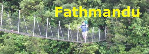
28 January 2007 Incline TrackThis walk begins at Greenwoods Corner, a bit over a kilometre from the Arataki Visitors Centre on the Scenic Drive. (Not the one on Manukau Rd) Note: on the map section below, borrowed from the ARC map itself - the topo map is well out of date - the Visitors' Centre appears to be on the wrong side of the road. The entire walk consisted of the Incline Track, the Nihotupu Dam road, the Pipeline Track and the Slip Track and a walk back along the Scenic Drive, whose beauties are difficult for a pedestrian to appreciate, given the attention necessary to avoid vehicles in the absence of footpaths
There is good parking here, and plenty of traffic passing most of the time to discourage break-ins. However, as I was sitting in the van over a coffee after the walk, there was a thump on the side of the van and Alice leapt up to investigate. I went out for a look and found my front indicator light smashed, and on the ground beside the front of the van was a smashed tail-light from another vehicle. It may just have fallen off a passing vehicle with the rest due to centrifugal force and karma, and bounced across the road until I got in the way, or it may have been a passing westie getting some target practice at a large and stationery target before graduating to police cars. It happens. There are two sections to the Incline Track: the first from the Scenic Drive along the Nihotupu Railway line, which does not appear to have an official name or number in the ARC track scheme, and the Incline Track proper, from the railway to the Nihotupu Dam Road.
Section 1: Nihotupu Railway Walk This is the dream family walk. It's just about level all the way, it's attractive and peaceful walking 2-3 abreast for most of it. The plants along the way are in good heart — there are some especially fine and vigorous specimens of koromiko, and it's about 45-60 minutes return, fatman time — about 1.8 km total. Along the way are some great views out over the hills as well. You might even get to see a train going past. (If you like, you can extend the level walk past the railway line, and round to the other side of the Hauler tunnel. The Incline Track continues, away from the railway track, and a hundred or so metres further along heads downhill to the left while a right hand branch with no signpost continues more or less level tp the other side of the tunnel.)
The first 100 metres or so is road access to a gravel and materials storage area. Very prominent among the usual suspects is houhere or lacebark. I am not well up on this genus, but I'd guess this to be Hoheria populnea.
I am already feeling calmer, and cooler, though by the end of the walk today I will be sunburnt right through my shirt. Something to remember in future. Some materials do not block the sun's rays. It's a microfibre one, designed for easy-wash, superfast dry and "dealing to perspiration", and I got it for the big walks when clean clothes are hard to come by, but it don't stop sunburn.
As I said earlier, the vegetation is lush and in good heart. In the picture below, hangehange is central, with karamu, kawakawa, and gorse. Down near the bottom are palm leaf fern and koromiko
We reach the storage area and I read all the notices forbidding access to rail tunnels. We hang a right along the section of rail track that is accessible to the public.
These are always a pissoff. Alice on a lead is still a pain, especially if I need to use my sticks. Alice off a lead usually stays on the track and within 50m, but that's not guaranteed. She also likes autographing people's clean trousers if we meet them along the way. I think I can now confidently pronounce the Japanese for "Shit!" and "F*** off!" I'm seriously thinking about a lightweight muzzle that will prevent her from eating anything, that we can take off to give her a drink. Jumping up is still an issue, though she is getting better. Her latest trick is standing squarely in front of approaching walkers and challenging them vociferously. I'm trying to teach her to drop a fernleaf in front of them first. There could be paid employment here meeting visiting overseas dognitaries.
Off we go As I said, it's beautiful walking, almost parklike.
Not a great deal of shade, though. The lushness of the vegetation just keeps on grabbing me.
That mingimingi is amazingly intense and in your face. The Waitakeres do rata very well. Here, the pipeline beside the track sports a fine crop. It's one host, though, that the rata is likely to have difficulty strangling.
The big leaves of Coprosma australis also feature strongly. Damn. I've just done a name check with New Zealand Plant Conservation Network, who are pretty much the last word on name changes and current authority. This plant is correctly known as Coprosma grandifolia. I've been calling it C. australis since I first went looking for its name. Anyway, here it is:
The occasional damp spots beside the pipeline feature a colourful groundcover of parataniwha.
|
|


